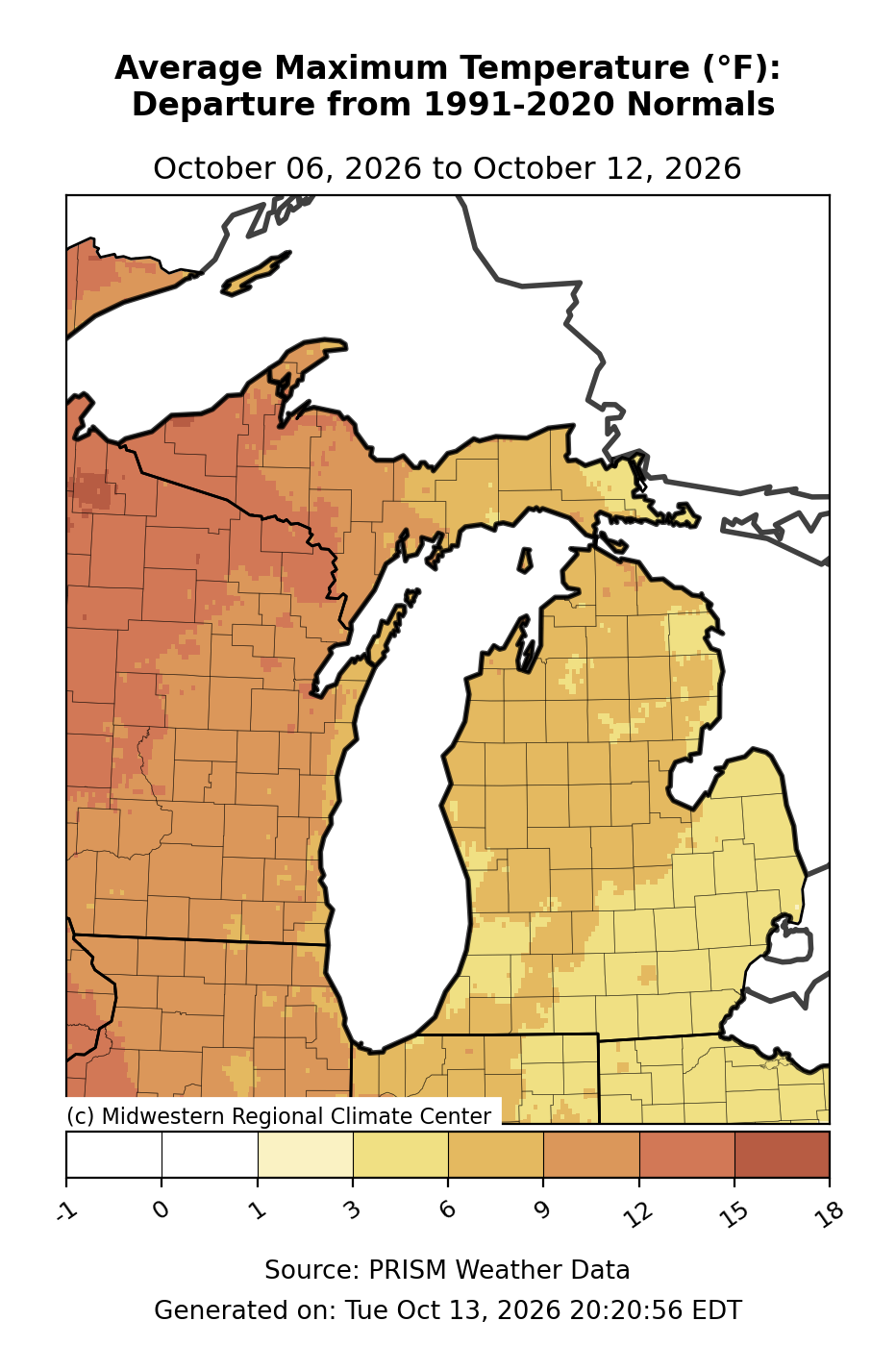
Average High Temperature - Departure from Mean
Regional text values
October 6, 2026 to October 12, 2026
Western Upper Peninsula: the most frequent sampled color represents 9 to 12 degrees F. Central Upper Peninsula: the most frequent sampled color represents 6 to 9 degrees F. Eastern Upper Peninsula: the most frequent sampled color represents 6 to 9 degrees F. Northern Lower Peninsula: the most frequent sampled color represents 6 to 9 degrees F. Central Lower Peninsula: the most frequent sampled color represents 6 to 9 degrees F. Thumb: the most frequent sampled color represents 3 to 6 degrees F. Southern Lower Peninsula: the most frequent sampled color represents 3 to 6 degrees F.
Legend boundaries (degrees F): -1, 0, 1, 3, 6, 9, 12, 15, 18.
Approximate color-band samples from seven Michigan regions in this exact map image. These are not station measurements, regional averages, or full-region minima and maxima. Shared colors span multiple legend intervals; those intervals are combined. The underlying gridded numbers are not supplied with the image.
Midwestern Regional Climate Center · PRISM Weather Data. Generated Tue Oct 13, 2026 20:20:56 EDT.
Updated .
| Michigan region | Most frequent sampled band | All sampled bands |
|---|---|---|
| Western Upper Peninsula | 9 to 12 | 9 to 12, 12 to 15 |
| Central Upper Peninsula | 6 to 9 | 6 to 9, 9 to 12 |
| Eastern Upper Peninsula | 6 to 9 | 3 to 6, 6 to 9 |
| Northern Lower Peninsula | 6 to 9 | 3 to 6, 6 to 9 |
| Central Lower Peninsula | 6 to 9 | 6 to 9 |
| Thumb | 3 to 6 | 3 to 6 |
| Southern Lower Peninsula | 3 to 6 | 3 to 6, 6 to 9 |